
Portafolio
Centro Empresarial Juan de Arona (CEJA), Lima, Peru

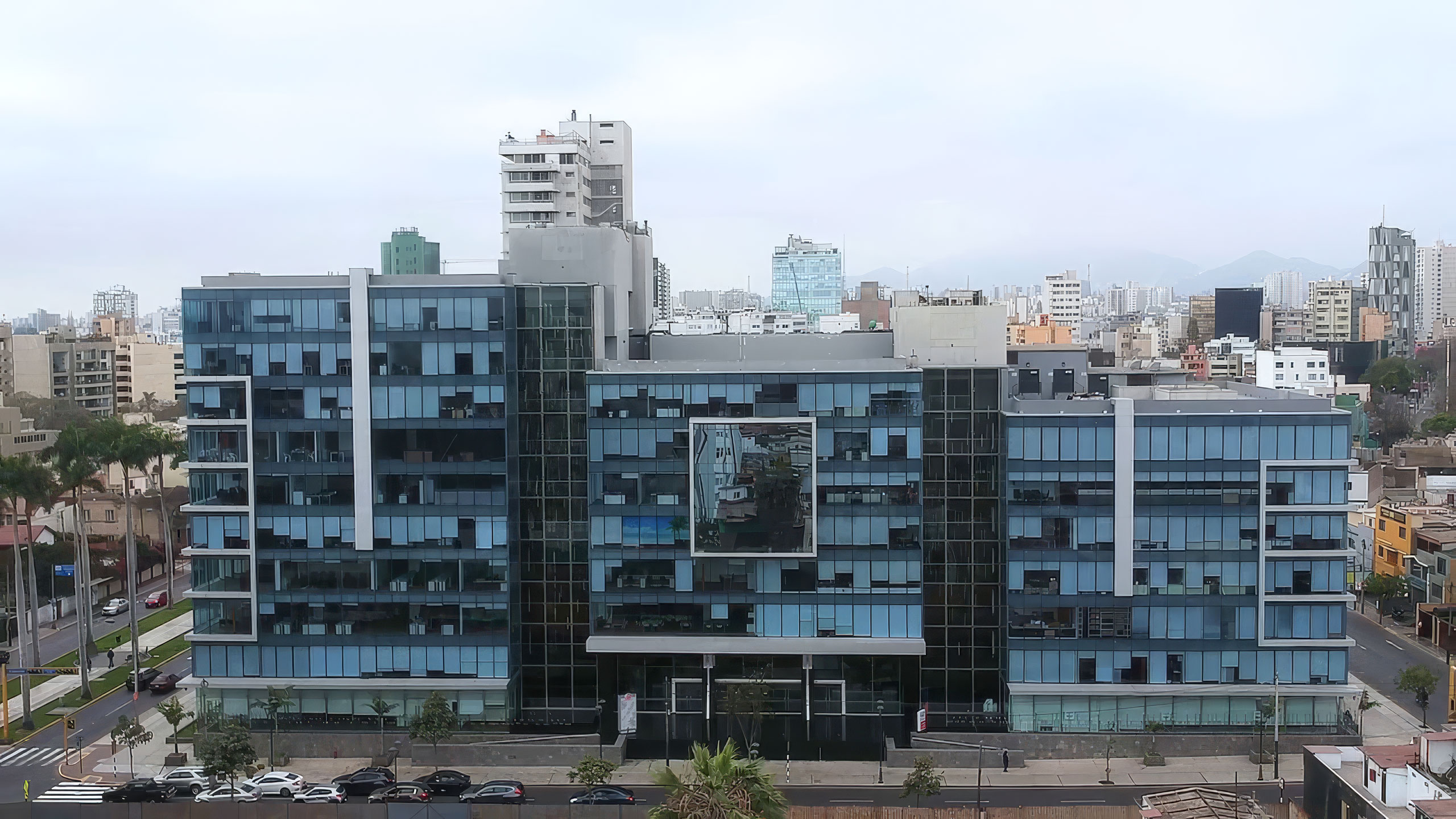
Three office towers, one integrated complex, one of the most seismically active coastlines in the world. Estructura instrumented all three CEJA towers so building management can see how the whole facility responds to every earthquake, in real time.
Trasfondo
The Centro Empresarial Juan de Arona is a corporate office complex at Av. Juan de Arona 151 in San Isidro, Lima's financial district. It sits between the business corridors of Av. Rivera Navarrete and Camino Real and is organized as three towers (A, B and C) that share a central entrance lobby, common services and more than 600 parking spaces. Its corporate tenants include Estructura's own Lima office.
Lima lies above the subduction zone where the Nazca plate dives beneath the South American plate, one of the most productive earthquake sources on the planet. Peru's seismic design standard, Norma E.030, reflects that reality, and large buildings in the capital are expected to plan for strong shaking within their service life.
Challenge
In an integrated complex, an earthquake is never a single-building problem. The three towers share a podium, basements and circulation, so a decision about one affects the occupants of all three. After a significant event, building management needs to know quickly whether each tower can be reoccupied, or whether hundreds of tenants must stay out while engineers carry out a visual survey.
CEJA's administration wanted objective, tower-by-tower data that would let them keep tenants safe without unnecessary evacuations, and give their structural engineers a measured record of how the complex behaves over time. [Peru's Norma E.030 also requires accelerometric instrumentation in large buildings, which made a monitoring program a compliance priority as well as a safety one.]
Solution
Estructura designed and installed a Structural Health Monitoring system across all three towers of the complex. [Each tower was instrumented with AC-7x triaxial accelerometers at the base, at an intermediate level and at the roof, recorded by a GMSplus digital recorder per tower, plus a free-field sensor that captures ground motion independent of the buildings.]
All three towers report to a single GeoSMART dashboard. After any earthquake, the system calculates displacement, interstory drift and response spectra for each tower and compares them with thresholds defined by the project's structural engineers. Within minutes, management receives a status report for every building, showing which towers remained within safe limits and which, if any, should be inspected first.
Between events, the archived data documents how the complex responds to everyday vibration and to the frequent small earthquakes felt in Lima, building a long-term structural record for maintenance planning. The engineers keep the final authority; CEJA now has the data to support their decisions from the first minutes after an event.
Another solution using GeoSIG instruments and a capable partner, showing that quality and reliability can also be cost-effective.
Nuestros proyectos
Nuestros proyectos en el mundo que utilizan nuestras soluciones y tecnología.


