
Portafolio
Tren Urbano: Metro Rail System, San Juan, Puerto Rico

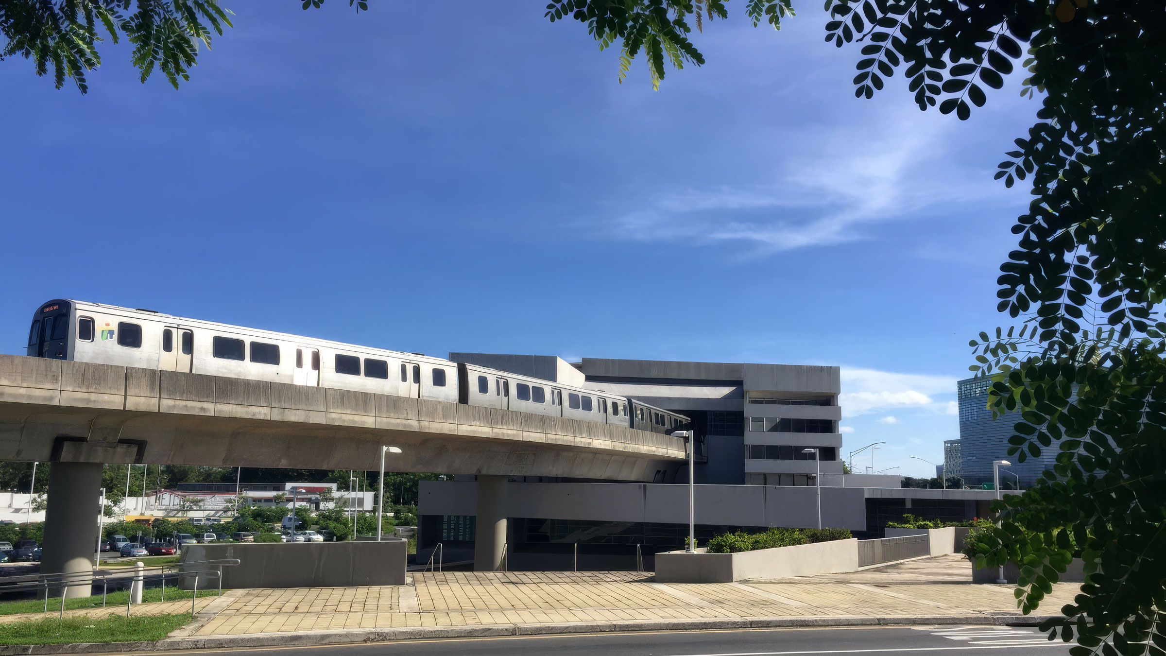
Puerto Rico's only rapid transit line runs 17.2 km through San Juan, Guaynabo and Bayamón and 16 stations, elevated, at grade and underground. Estructura instrumented every station, giving the system a single, continuous view of how its structures respond to earthquakes and daily operations.
Trasfondo
Tren Urbano is the rapid transit system of the San Juan metropolitan area. Its single line runs 17.2 km (10.7 miles) from Sagrado Corazón in Santurce to Bayamón, connecting Hato Rey's Milla de Oro financial district, the Río Piedras university district and the Centro Médico hospital complex. The system opened in December 2004 and began regular service in June 2005.
The line is a mix of structure types: elevated stations on concrete viaducts, at-grade stations and underground stations beneath Río Piedras. Hato Rey station sits beside the Coliseo de Puerto Rico, another Estructura-monitored structure, and extends its hours after major events so crowds can leave safely.
Puerto Rico sits on the boundary between the North American and Caribbean plates. The Puerto Rico Trench to the north and the fault systems to the south, active during the 2019 to 2020 seismic sequence, keep earthquake preparedness at the top of the agenda for every public infrastructure operator on the island.
Challenge
A transit system cannot reopen on assumptions. After any significant earthquake, operators must decide quickly whether trains can keep running, which stations need inspection first, and when service can safely resume. Without instrumentation, that decision depends on visual inspection of 16 stations and kilometers of viaduct, a process that can keep the system closed for days while thousands of daily riders look for alternatives.
The operator needed objective data from every station: how much each structure actually moved, whether any exceeded its design thresholds, and which ones could return to service right away. The solution also had to work across very different structures, from tall elevated platforms to underground boxes, and report to one place.
Solution
Estructura designed and installed a system-wide Structural Health Monitoring network covering all 16 Tren Urbano stations. [Each station was fitted with triaxial AC-7x accelerometers at foundation and platform levels, connected to a GMSplus digital recorder on site.] All stations stream to GeoSMART, which presents the whole line in a single web interface with a 3D model of each station.
Within minutes of an event, GeoSMART reports peak accelerations, interstory drift and frequency changes station by station and compares them against thresholds set by the system's structural engineers. Stations that stay within limits show green; those that exceed them are flagged for priority inspection. [Alerts are delivered by email and to the operations control center.] The same data, archived continuously, lets the operator track long-term trends such as vibration from train traffic and gradual changes in structural stiffness.
[Estructura's TerraIntel satellite service complements the ground sensors by measuring millimeter-scale ground and structural deformation along the elevated viaduct between stations.]
The result is a transit system that can make its post-earthquake decisions on measured data, with inspectors sent first where they are most needed and structural engineers keeping the final word on every reopening.
Another solution using GeoSIG instruments and a capable partner, showing that quality and reliability can also be cost-effective.
Nuestros proyectos
Nuestros proyectos en el mundo que utilizan nuestras soluciones y tecnología.


